Things to Do
RV & Site Information
For RV enthusiasts planning a visit, BIG LARCH CAMPGROUND accommodates recreational vehicles up to 51 feet in length. This USDA Forest Service is available for advance reservation, making it a reliable choice for planned trips.
Guests at BIG LARCH CAMPGROUND can enjoy essential amenities including Accessible Vault Toilets, Vault Toilets, and Drinking Water (Peak Season). The site is maintained by USDA Forest Service, ensuring consistent upkeep and facilities management.
Popular activities at this location include Amphitheater, Beachcombing, Berry picking, and Biking. The campground's proximity to Seeley Lake offers convenient access to additional outdoor recreation opportunities in the Montana region.
Located in Seeley Lake, Montana, BIG LARCH CAMPGROUND provides bookable camping options for visitors exploring America's public lands. Contact the site directly for real-time availability and current conditions.
About this place
Overview Big Larch Campground is located on the east shoreline of Seeley Lake within the Lolo National Forest in Montana. A great place to cool off on a hot day, it has a beach and a boat ramp, as well as ample shade for those who just want to relax and enjoy nature. The campground is a favorite of locals, with plenty of space for camping, picnicking and recreating on the water. Recreation • The campground is popular for swimming, fishing, biking, paddling and boating. Anglers cast for a variety of freshwater fish including Kokanee salmon, bass, whitefish, pike, trout and perch, among other species. Water skiing is a popular activity on the lake. • The Clearwater Canoe Trailhead just North of Seeley Lake offers excellent flat water for viewing wildlife such as blue herons and river otters. The water trail is popular with canoeists and kayakers as it stretches 3.5 miles, or a couple of hours, down the river. • The Morrell Falls National Recreation Trail on the East side of the valley offers an incredible day hike exploring recent burns, dense forests, and a large waterfall. Facilities
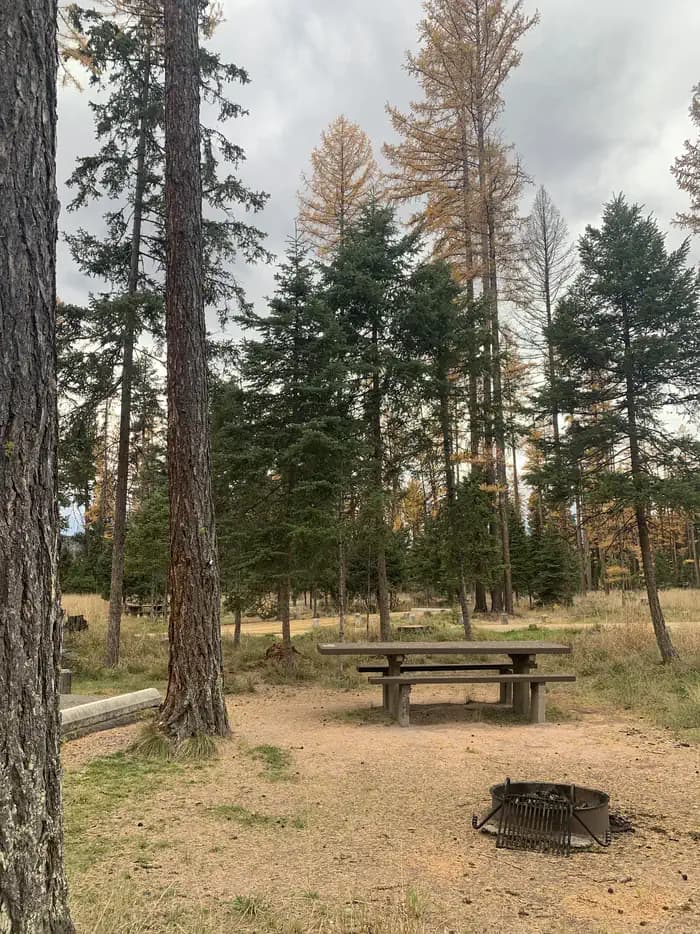
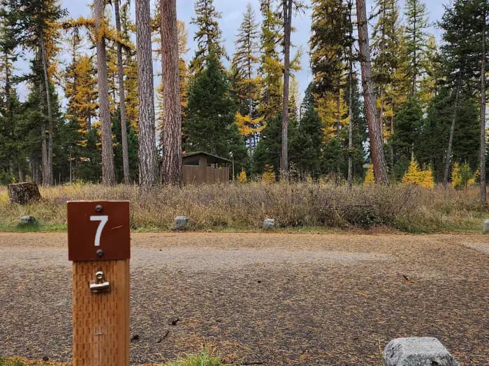
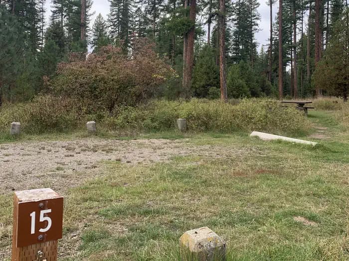
Two group camping areas, 29 individiual RV/tent campsites, and three bicycle campsites are available for reservation the Friday before Memorial Day to Labor Day. These campsites will transition to first-come/first-serve outside of these dates. 19 individual sites are available on a First-Come/First-Serve basis. These campsites can be paid for onsite by scanning a QR Code using the Recreation.gov mobile app. Visitors will need to download the free recreation.gov mobile app through Android or iOS. This is best done prior to arrival All campites are each equipped with picnic tables, campfire rings with grills, and a large paved parking area. Accessible vault toilets, drinking water and trash receptacles are avaliable throughout the campground. Campground hosts on site 24 hours a day. The campground also offers a spacious day use area that includes a roped-off swimming beach, a boat ramp, a dock, boat trailer parking, and several picnic areas. Day use facilities are open year-round from 6 a.m. - 10 p.m. daily. No fees or reservations are required for day use.
Natural Features
Big Larch Campground is located on the east shoreline of Seeley Lake, a 1,025 acre, glacial-formed lake within the "Chain of Lakes" - through which the Clearwater River flows. The campground is nestled in a mixed conifer forest, including plenty of tall larch and pine trees. While there is ample space between sites, the lack of understory makes for minimal privacy. At an elevation of about 4,000 feet, temperatures are pleasant throughout most of the summer months. The area contains a wide variety of wildlife and is home to white-tailed deer, elk, mountain goats, bighorn sheep, moose, grizzly and black bears (learn about bear safety ). Both the bald and golden eagle reside in the forest, along with trumpeter swan, herons and dozens of varieties of ducks.
Nearby Attractions • The town of Seeley Lake, MT on the southeastern tip of the lake offers a variety of recreation services such as boat, canoe, and kayak rentals as well as guide services and resorts. Services like gas, groceries, restaurants, and lodging can also be found in town. Access to a variety of forests, sweeping views, mountain lakes, and rugged peaks can be discovered just a short drive up any of the nearby Forest Service roads. • Just a day trip away from Seeley Lake, Glacier National Park is known for a variety of opportunities to explore alpine landscapes, active glaciers, and view unique wildlife. Contact the park for current conditions. • About an hour from Seeley Lake, Missoula is one of Western Montana’s outdoor recreation hubs. Missoula is a full-service city with 2 hospitals, an international airport, and access to services, hotels, and outdoor activities.
Getting There
From I-90: take exit 109 for MT-200 E and travel for 32.3 mi. Turn left onto MT-83 N and travel 14.0 mi to Seeley Lake, MT. Continue north on Highway 83 for 1 mile. The campground entrance is located on the west side of the highway. Directions to Group Sites: Continue straight at the first fork and the group sites will be on the left. To Sites in Loop 1 (sites 1-10): Turn left at the fork, then turn right at the first intersection. To Sites in Loop 2 (sites 14-28): Turn left at the fork, then turn right at the second intersection. To Sites in Loop 3 (sites 34-49): Turn left at the fork, then turn right at the third intersection. To Sites in Loop 4 (sites 11-13, 29-33, 50): Continue straight at the fork, follow the road past the group sites, swimming beach, and bike sites. Loop 4 campsites are located on both sides of the access road.