Things to Do
RV & Site Information
Guests at LOOKOUT BUTTE LOOKOUT can enjoy essential amenities including Pit Toilets. The site is maintained by USDA Forest Service, ensuring consistent upkeep and facilities management.
Popular activities at this location include Camping, Hiking, and Historic & cultural site. The campground's proximity to KOOSKIA offers convenient access to additional outdoor recreation opportunities in the Idaho region.
Located in KOOSKIA, Idaho, LOOKOUT BUTTE LOOKOUT provides bookable camping options for visitors exploring America's public lands. Contact the site directly for real-time availability and current conditions.
About this place
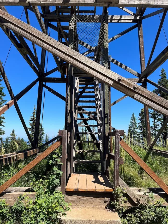
Overview Lookout Butte has a history that spans nearly 80 years and has been home to three lookout towers. The first, built in 1923, was 45 feet tall with just a platform on which to stand. A cabin was put on the tower a couple years later. In 1935, a 50-foot tower was constructed. A new tower was built beside the old one in 1962, and this is currently available for rent.
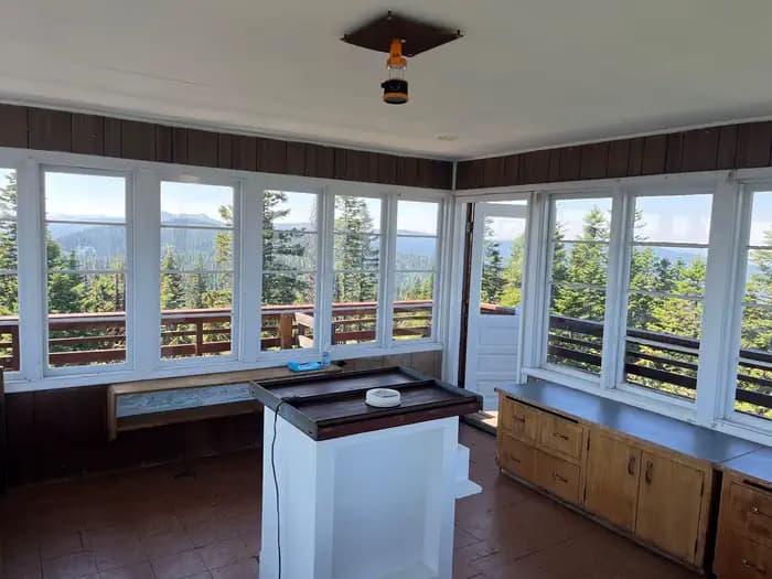
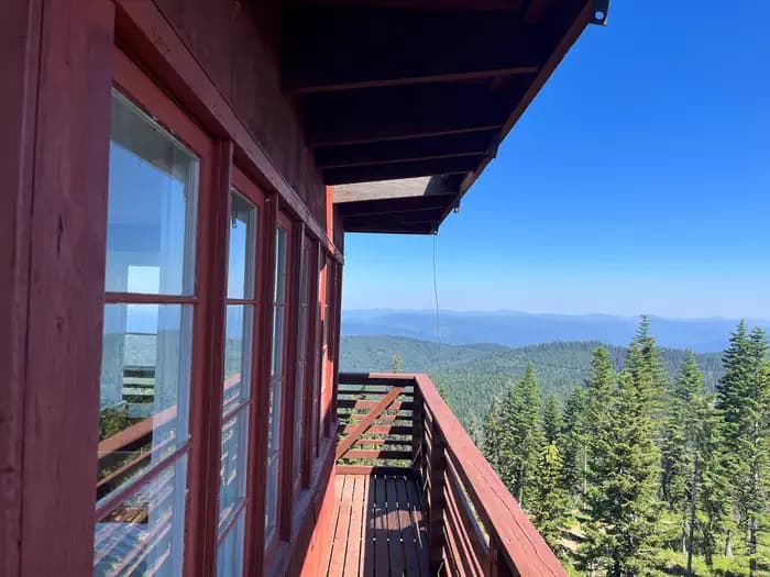
The current 60-foot wooden tower offers panoramic views and the perfect setting for enjoying the area's tranquility and natural beauty. Guests can enjoy the scenery from the exterior catwalk or from inside the single-room cabin.Recreation Several primitive roads in the area are open to mountain biking and off-road vehicles. Other activities in the area include hiking through second-growth forest and birding.Facilities The lookout has room for up to four people and comes with two twin beds with foam mattresses and two cots. Other amenities include a propane stove and oven, a table and chairs, a broom, a bucket and a mop. A pit toilet sits downhill to the south of the lookout, and there's a campfire ring near the base. Guests should be prepared to haul supplies up five flights of stairs. Guests are required to bring their own drinking water. Other recommended supplies include food, sleeping bags or bedding, coolers, cookware and utensils, dishes, warm clothing and rain gear, flashlights, extra batteries, first aid kit, matches, toilet paper, garbage bags and the combination for the lookout and gate. Click here for more information about this lookout.Natural Features The lookout sits at 5,869 feet in elevation with breathtaking views of the Selway Crags in the Selway-Bitterroot Wilderness area, the Seven Devils Mountain Range, Coolwater Ridge, Pilot Knob Lookout and the Lochsa and Selway River drainages. Nearby Attractions Guests can take a sightseeing drive from Lowell to Selway Falls and back. This 42-mile drive offers opportunities to appreciate the pristine beauty of the Selway River, a Wild and Scenic River, as well as picturesque Selway Falls.
Getting There
Travel to Lowell, Idaho, located approximately midway between Lewiston, Idaho and Missoula, Montana on Highway 12, milepost 97. Cross the Selway Bridge, drive 3.5 miles and cross the Swiftwater Bridge on your right. Follow the signs 13 miles for about 1 hour to the lookout.
Alternative Route From Hwy 12, cross the middle fork of the Clearwater River at the bridge above Kooskia (MP 74) turn left onto paved County Road 1842, towards the Kooskia National Fish Hatchery, pass the fish hatchery approximately, 3.5 miles stay to the left on County Route 286 for approximately 5 miles when it will convert from County Road to Forest Road 286 and turn into a gravel road. Follow Forest Road 286 for an additional 8 miles where Forest Road #470 joins from the left. Stay right on #286 for approximately 1.5 miles to the junction of Road #286 w/ Forest Road #1129 and take a left onto #1129. Travel approximately 1.3 miles and the spur road to Lookout Butte Lookout is signed and to the right. It is about 1/8th of a mile up the lookout from the main road. This last segment is a rough, outsloped, native surface road that requires high clearance to reach Lookout Butte Lookout Tower.