Things to Do
RV & Site Information
For RV enthusiasts planning a visit, Steel Creek Campground accommodates recreational vehicles up to 1 feet in length. This National Park Service is available for advance reservation, making it a reliable choice for planned trips.
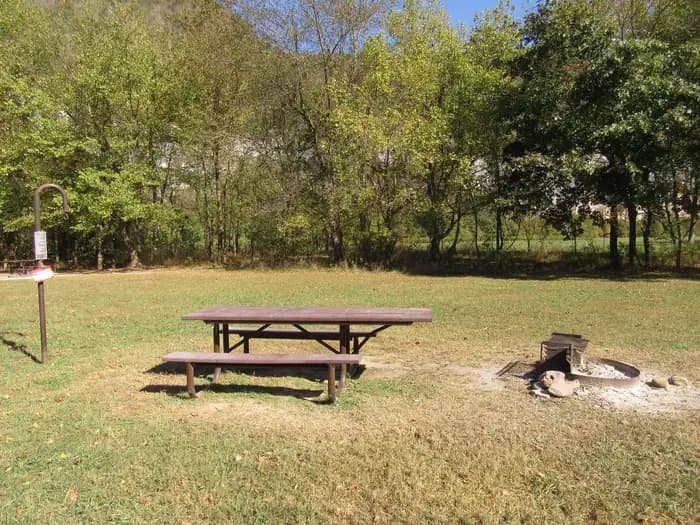
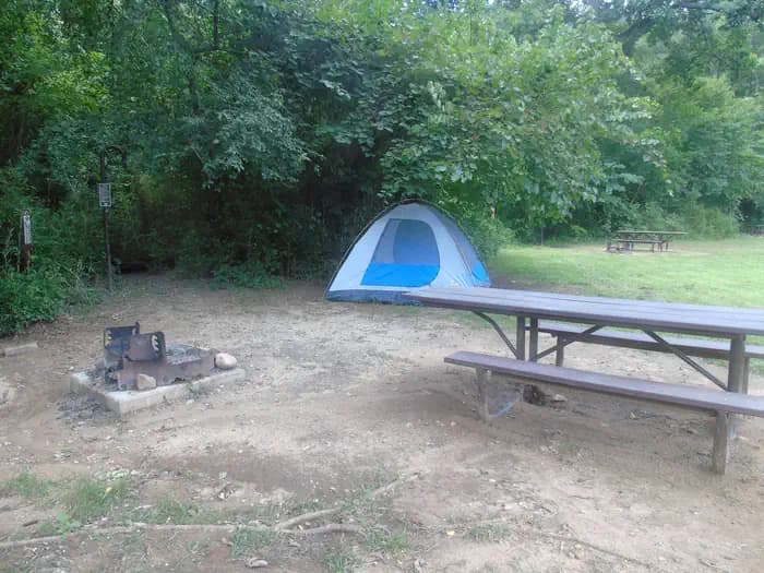
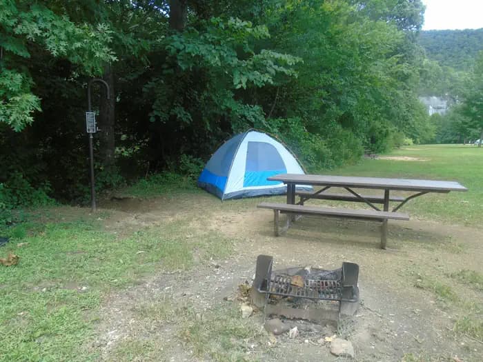
Guests at Steel Creek Campground can enjoy essential amenities including Water (Seasonal), Drinking Water (Hand Pump), and Proximity to Water: Riverfront. The site is maintained by National Park Service, ensuring consistent upkeep and facilities management.
Popular activities at this location include Camping, Canoeing, Fishing, and Hiking. The campground's proximity to Jasper offers convenient access to additional outdoor recreation opportunities in the Arkansas region.
Located in Jasper, Arkansas, Steel Creek Campground provides bookable camping options for visitors exploring America's public lands. Contact the site directly for real-time availability and current conditions.
About this place
Overview Steel Creek Campground is situated along the Buffalo River under the towering and picturesque Roark Bluff. One section of the campground offers 26 walk-in tent sites and another section of the campground offers 14 sites for those camping with horses. Half of the sites in the campground are available for reservations. Steel Creek is located about 3 miles (5 km) east of Ponca, just off Highway 74. Recreation Floating conditions in the upper (westernmost) district of Buffalo National River are extremely dependent upon rainfall. On an average year, the upper river is only navigable by boat in the spring and early summer when consistent rainfall feeds into the watershed. Some sections on the upper end of the river are technical and should not be attempted by novices. For current floating conditions, please check with an outfitter (visit our Guided Services web page ), call the Tyler Bend Visitor Center at 870-439-2502, or check the USGS Buffalo River Floating Conditions web page. Facilities Steel Creek has 26 tent only sites and 13 sites for campers with horses/stock animals (six people and four stock animals allowed per site). There are no electrical amenities or water hookups, but flush restrooms and water spigots are available from approximately March 15 through November 15 each year.Natural Features The Buffalo National River flows free over swift running rapids and quiet pools for its 135-mile (217 km) length. One of the few remaining rivers in the lower 48 states without dams, the Buffalo cuts its way through massive limestone bluffs traveling eastward through the Arkansas Ozarks and into the White River.
Nearby Attractions The Buffalo River Trail runs through Steel Creek and offers great day hiking or overnight backcountry opportunities. Boxley Valley is nearby and is home to Lost Valley, an easy to moderate trail that leads hikers past geologic and water formations. Visit the park's Hiking Trails web page for more information.. Contact Info For facility specific information, please call (870) 439-2502.Charges & Cancellations rules and reservation policies
Getting There
From Fayetteville, Arkansas drive north and take US Highway 412 East for approximately 42 miles (67.5 km) to the intersection with State Highway 21. Take highway 21 South for approximately 17 miles (27 km) to the intersection of State Highway 43. Here, take highway 43 East for about 5 miles (8 km) to the intersection of State Highway 74. Here, turn right onto highway 74 and drive about 2 miles (3.2 km) to Steel Creek Road. Turn left and drive approximately .5 miles (.8 km) down into the campground. At the bottom of the hill the main campground will be to your left and the horse camp will be to your right. From Little Rock, Arkansas take Interstate 40 West for approximately 93 miles (150 km) to Exit 64. At Exit 64 take Business Highway 64 west through the town of Lamar for about 4 miles (6.5 km) to the intersection of State Highway 21. Take Highway North for about 48 miles (77 km) to the intersection of State Highway 43. Here, take highway 43 East for about 5 miles (8 km) to the intersection of State Highway 74. Here, turn right onto highway 74 and drive about 2 miles (3.2 km) to Steel Creek Road. Turn left and drive approximately .5 miles (.8 km) down into the campground. At the bottom of the hill the main campground will be your left and the horse camp will be on your right. From Springfield, Missouri take US Highway 65 South for approximately 70 miles (112.6 km) to the town of Harrison. In Harrison, take State Highway 7 South about 1 mile (1.6 km) through downtown Harrison until you come to the intersection of State Highway 43 on your right. Follow highway 43 for about 25 miles (40 km) until to get to the intersection of State Highway 74. Turn left onto highway 74 and drive about 2 miles (3.2 km) to Steel Creek Road. Turn left and drive approximately .5 miles (.8 km) down into the campground. At the bottom of the hill the main campground will be your left and the horse camp will be on your right.