Things to Do
RV & Site Information
For RV enthusiasts planning a visit, FOSCUE CREEK accommodates recreational vehicles up to 189 feet in length. This US Army Corps of Engineers is available for advance reservation, making it a reliable choice for planned trips.
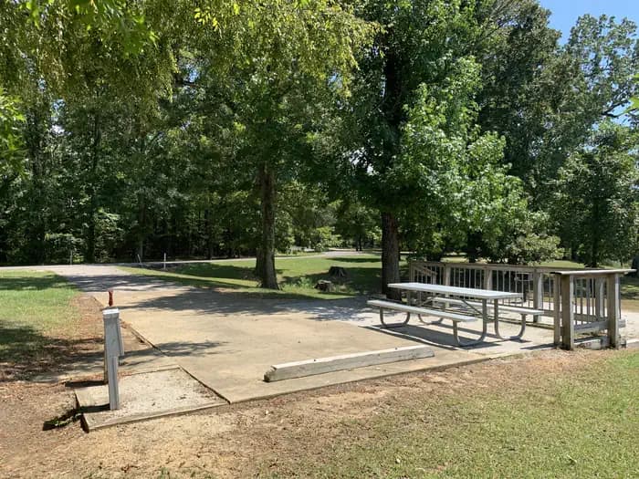
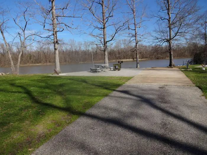
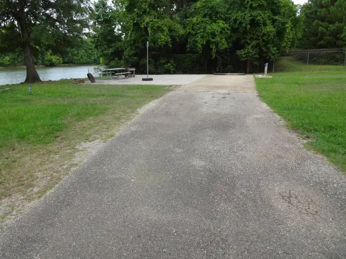
Guests at FOSCUE CREEK can enjoy essential amenities including Proximity to Water: Riverfront, and Water Hookup. The site is maintained by US Army Corps of Engineers, ensuring consistent upkeep and facilities management.
Popular activities at this location include Boating, Camping, Fishing, and Water sports. The campground's proximity to Demopolis offers convenient access to additional outdoor recreation opportunities in the Alabama region.
Located in Demopolis, Alabama, FOSCUE CREEK provides bookable camping options for visitors exploring America's public lands. Contact the site directly for real-time availability and current conditions.
About this place
Overview Foscue Creek Campground is nestled on the forested lake shore of Demopolis Lake, the largest lake on the Black Warrior-Tombigbee Waterway.
Demopolis Lake offers 10,000 acres of water to explore. The region is excellent for hunting, and game is plentiful.
Foscue Creek Campground offers a peaceful retreat for families, anglers, boaters and those who want to get away any time of year.Recreation Fishing and hunting are the most popular activities in the area. Whether fishing by boat or along the bank of the park, anglers can fish for bass, crappie, bream, catfish and other species.
Day-use visitors and campers alike can enjoy a boat ramp and hiking trail at the campground. Foscue Creek Nature Trail takes walkers and joggers along the shoreline and provides benches for wildlife viewing and trail markers for tree identification.Facilities This facility has both a day-use area and a campground. There are four shelters for group picnics of between 25 to 80 people.
The 54 campsites feature picnic tables, lantern holders and campfire rings with grill. Campsites are spacious, private and located near or close to the water.Natural Features The campground lies south of the confluence of the Black Warrior and Tombigbee Rivers. The Black Belt region of Alabama is a diverse area of dense conifer stands and rolling meadows that feature colorful wildflower displays. Wood ducks, bald eagles, blue birds and many other species of wildlife inhabit the lake area.
Black Warrior-Tombigbee Waterway consists of six lakes with a total length of 457 miles and 39,800 surface acres of water. Contact Info For facility specific information, please call (334) 402-1608.
Getting There
From Demopolis, Alabama, drive three miles west on U.S. Highway 80, and turn right at Maria Street. Go approximately two miles and follow signs to the campground entrance. It is strongly recommended not to follow GPS directions to the campground when traveling U.S. Highway 43 South to Jackson Street. Jackson Street is not conducive for camper/motorhome travel. The best travel option is utilizing U.S. Highway 80 to Maria Street as stated above.DO NOT FOLLOW GPS DIRECTIONS TO FOSCUE CREEK. These directions are not favorable when pulling a camping unit.Recommended Directions:Traveling from the north on Highway 43 south - in Demopolis take a (left) on truck route Highway 43, then a (right) on Highway 80 west, then a (right) on Maria Ave., then merge to your (left) onto Lock and Dam Road, cross two sets of railroad tracks and 1800 Lock and Dam Road/park entrance will be on the right.Traveling in from the south on Highway 43 north - in Demopolis take a (left) on Highway 80 west, then a (right) on Maria Ave., then merge to your (left) onto Lock and Dam Road, cross two sets of railroad tracks and 1800 Lock and Dam Road Park/ entrance will be on your right.Traveling in from the east on Highway 80 west – make a (right) on Maria Ave., then merge to your (left) onto Lock and Dam Road, cross two sets of railroad tracks and 1800 Lock and Dam Road/park entrance will be on your right.Traveling in from the west on Highway 80 east - make a (left) on Maria Ave., then merge to your (left) onto Lock and Dam Road, cross two sets of railroad tracks and 1800 Lock and Dam Road/park entrance will be on your right.